Data availability
In the previous section, we loaded the Landsat 8 dataset onto the Digital Earth Africa Map and saw it only covers certain parts of Africa on each day. The section on Digital Earth Africa products tells us Landsat 8 data is only available at certain times in some countries.
How do we know specifically where and when data is available? Before we start any analysis, we can answer this question by verifying existing data on the Digital Earth Africa Metadata Explorer. The Metadata Explorer can be found at https://explorer.digitalearth.africa/.
Overview
In this section, we will use the Digital Earth Africa Metadata Explorer to check where data is available for a selected time period. The place we will investigate is Tanzania, for the time period of 2018.
Map or Explorer?
The Digital Earth Africa Metadata Explorer and Digital Earth Africa Map look similar, but they are designed for different purposes.
Use the Digital Earth Africa Map if you:
Want to see what the product or dataset looks like
Use the Digital Earth Africa Metadata Explorer if you:
Want to know exactly where and when you can find data
Exercise: Data for Tanzania in 2018
Open the Digital Earth Africa Metadata Explorer
Open https://explorer.digitalearth.africa/. This will display the Metadata Explorer user interface.
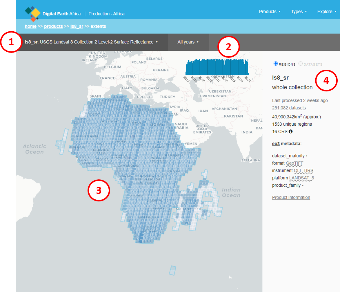
The Digital Earth Africa Metadata Explorer has four main sections.
Product selection: This shows the currently-selected product. Click the selected product name to open the products dropdown menu.
Time period: This shows the time period for which the selected product is being displayed. Click the selected time period to open the time selection dropdown menu.
Map display: This shows where data is available, for the selected time and product. Blue shaded tiles indicate the presence of data.
Product information: The sidebar shows more information about the data for the selected time and product. For example, this includes how many datasets are selected, the name of the datasets in the product, and its coordinate reference system.
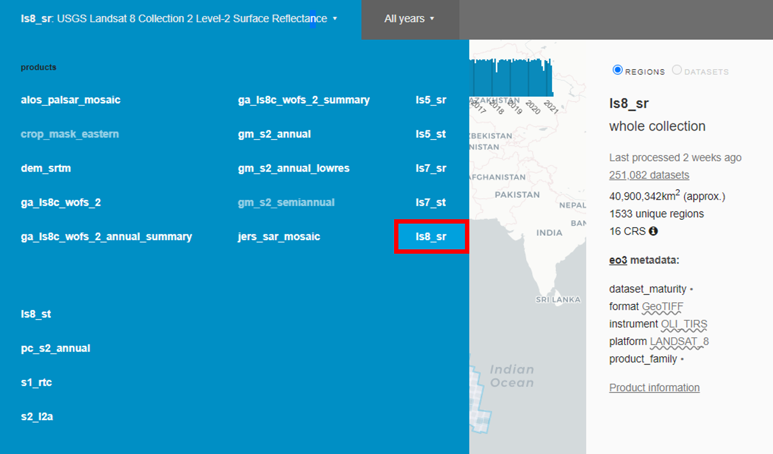
Select the Landsat 8 product
Click the product selection bar to open the dropdown menu. Select ls8_sr. This selects the Landsat 8 product.
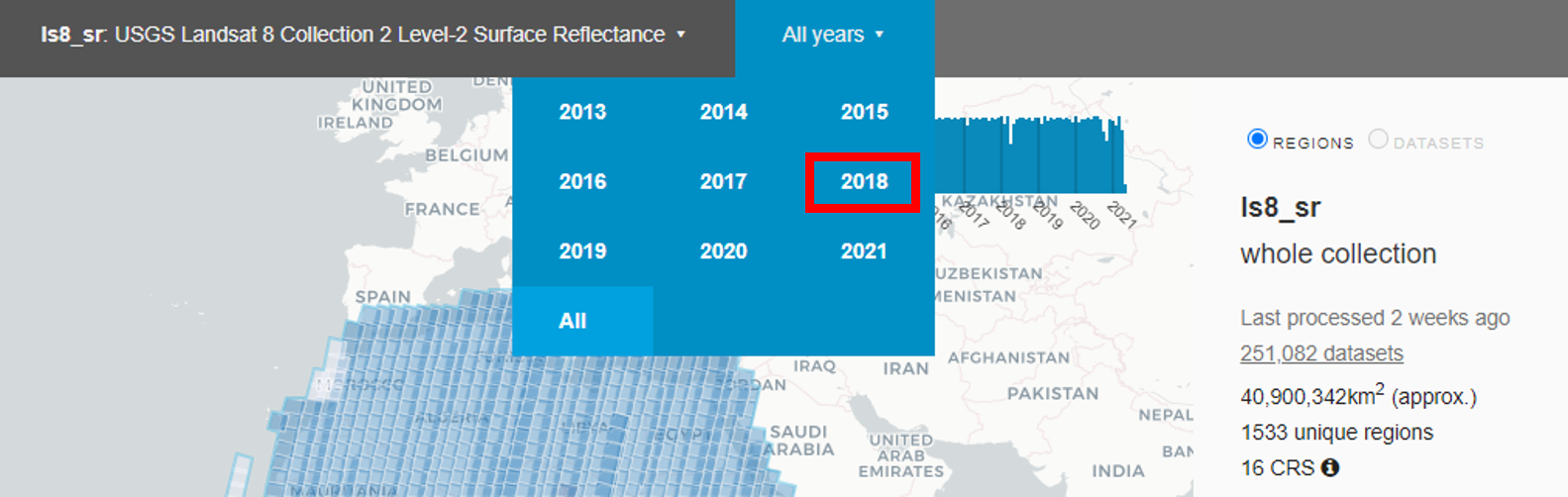
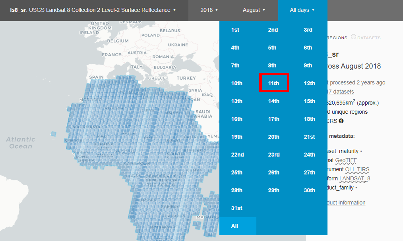
Click the time bar to open the dropdown menu. Select 2018. This will show all Landsat 8 datasets for 2018.
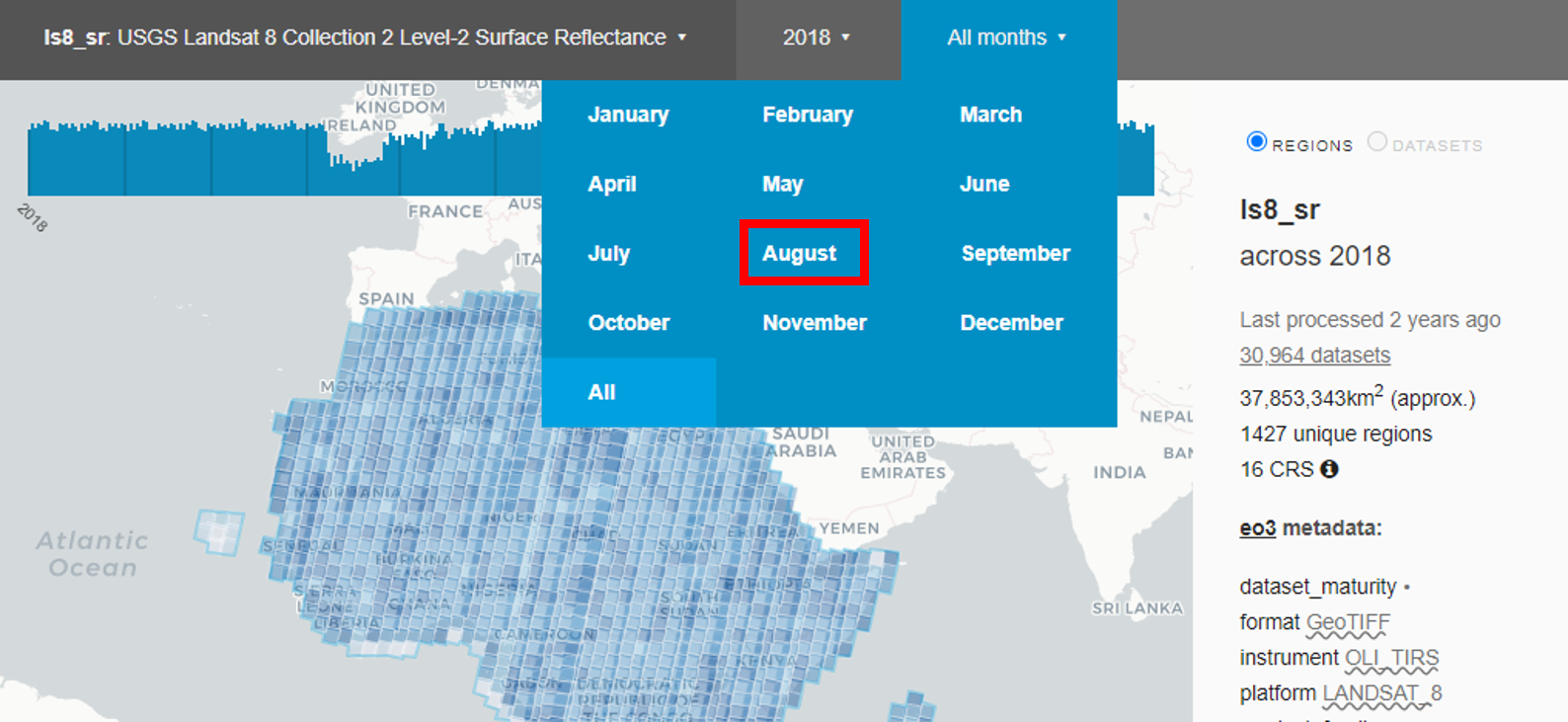
Click the all months bar to open the dropdown menu. Select August. This will show all the Landsat 8 datasets for August 2018.
Click the all days bar to open the dropdown menu. Select 11th. This will show all the Landsat 8 datasets for 11 August 2018.
The map display will now show all the Landsat 8 datasets for 11 August 2018 as blue shaded boxes. Use the + button on the map to zoom in, and click and drag to pan the map.
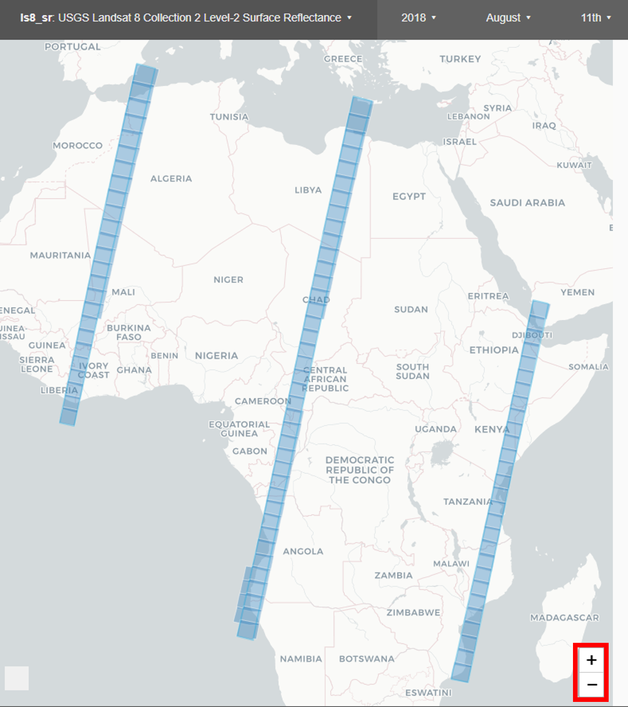
We can see that there is only data available for some African countries. Let’s take a closer look at Tanzania.
Zoom in on Tanzania
Use the map’s + button to zoom in on Africa. Click and drag to see Tanzania.
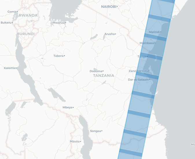
We can see the data for 11 August 2018 (blue shaded boxes) covers certain parts of Tanzania, which means areas within Tanzania are a suitable location to choose for data analysis for that day. For example, for that day (11 August 2018) we would not be able to do any Landsat 8 analysis over the city of Dodoma in Tanzania, as it does not have any data available for that time.
Conclusion
You now know how to use the Digital Earth Africa Metadata Explorer to check where and when you can perform data analysis. The next step is loading the data.